4th-Year | Spring 2026 | ARCH542 | Professor Frances Hsu | Alcoa & Maryville, TN | University of Tennessee, Knoxville
Cultivated Infrastructure reimagines an existing energy corridor as a new form of public and food production infrastructure for an adjacent residential neighborhood and redeveloped manufacturing campus. With energy systems moved underground for efficiency and public safety, this corridor transformed into an elevated pathway that organizes circulation, occupation, and access to urban agriculture programs across the site. Community hydroponic gardens, orchards, allotment greenhouses, and public gathering spaces become integrated into the infrastructural system. By transforming an industrial and energy corridor into occupiable, productive environments, Cultivated Infrastructure proposes infrastructure as a civic resource that supports urban agriculture, education, and community engagement.
Phase 1 - Territorial Systems
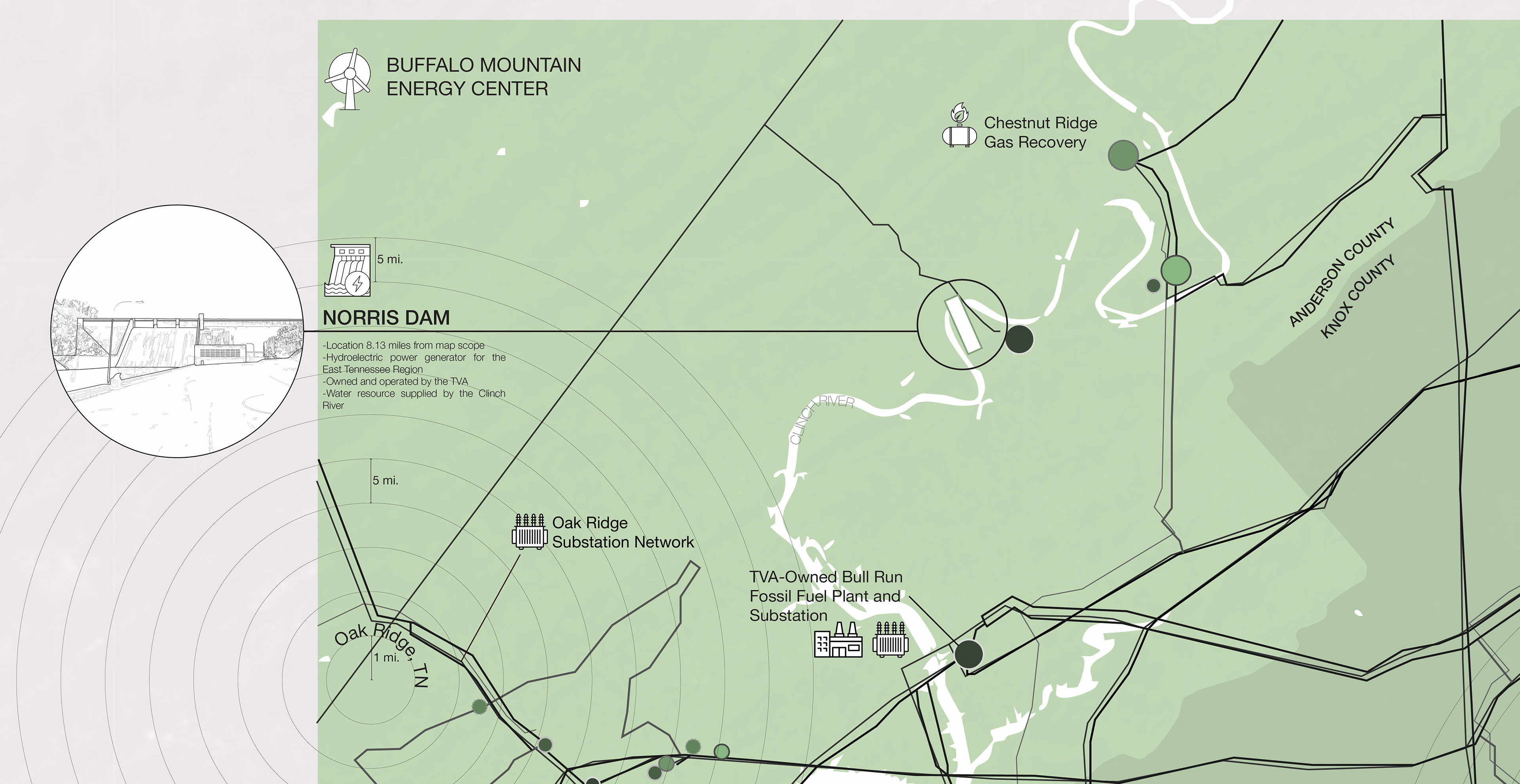
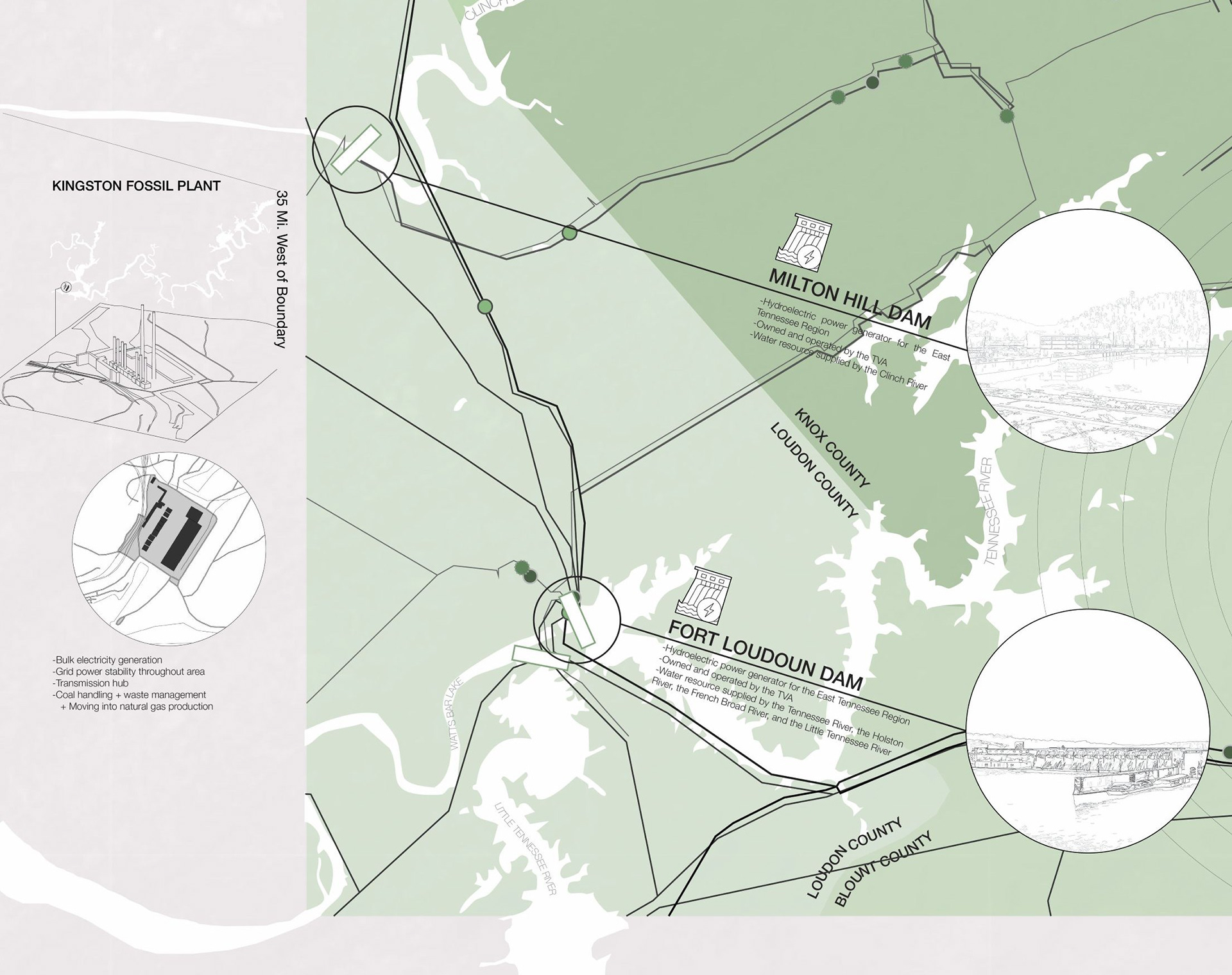
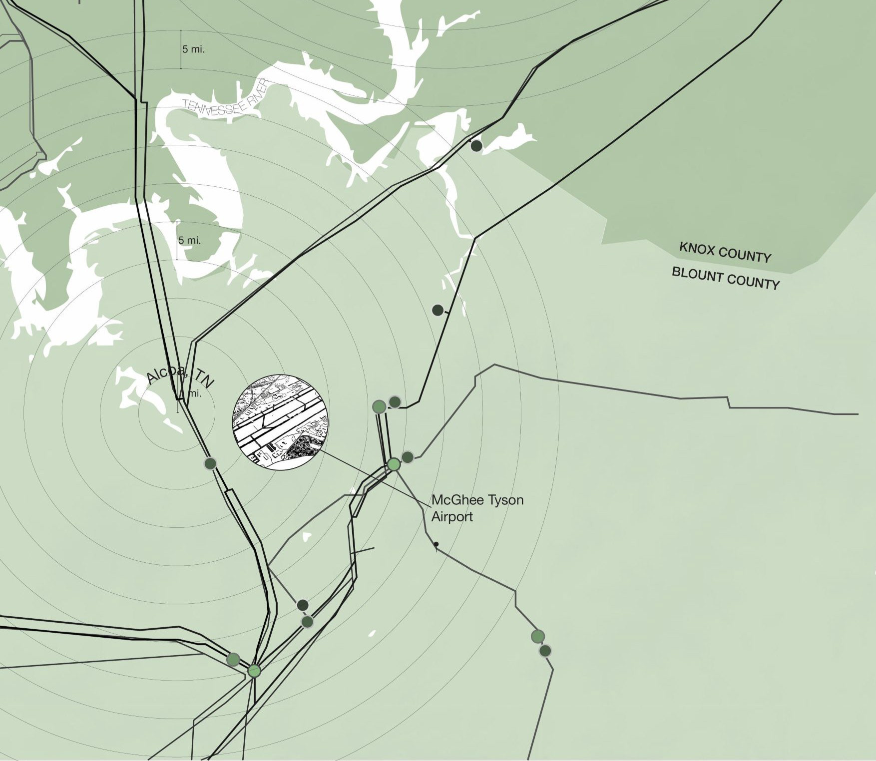
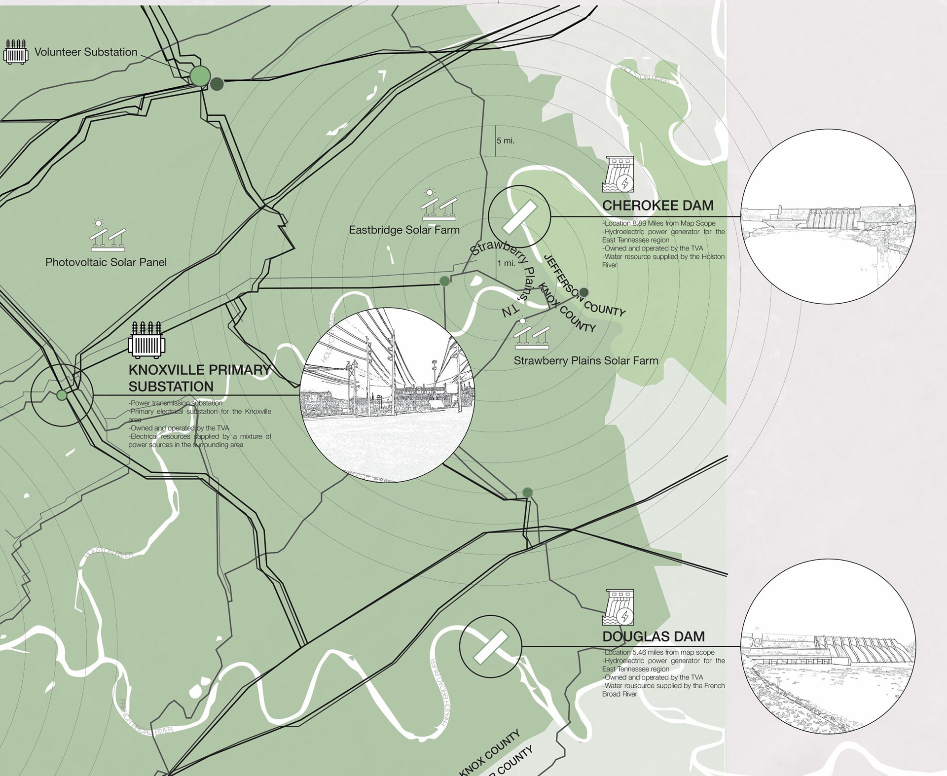
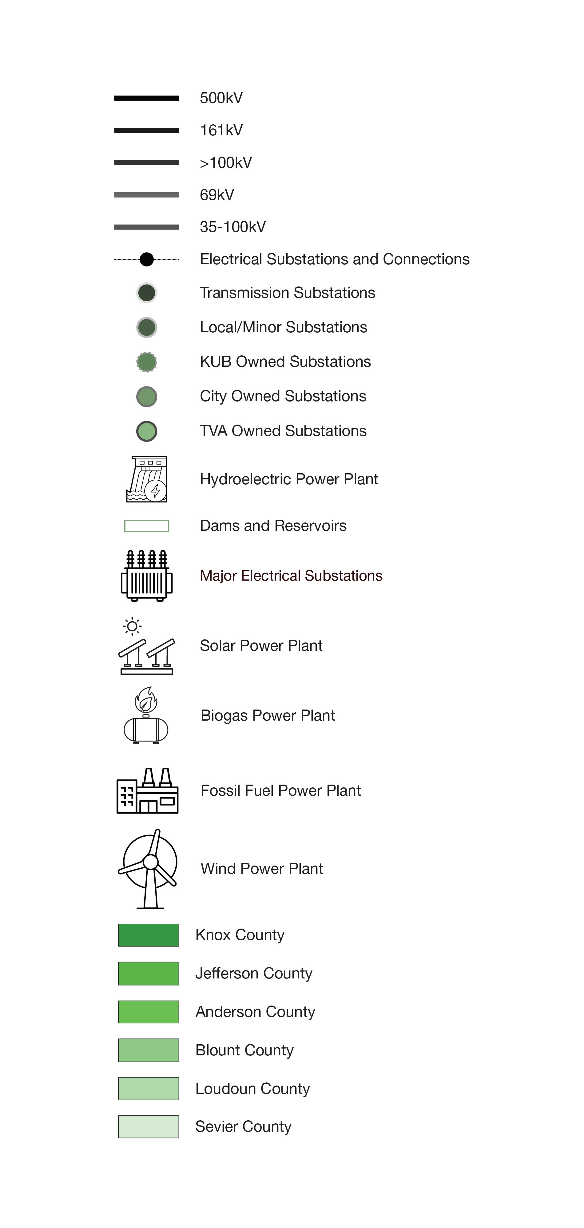
This project began with investigating infrastructural systems of electrical power lines, substations, and power plants within the Knoxville Free-Trade Zone in Tennessee.
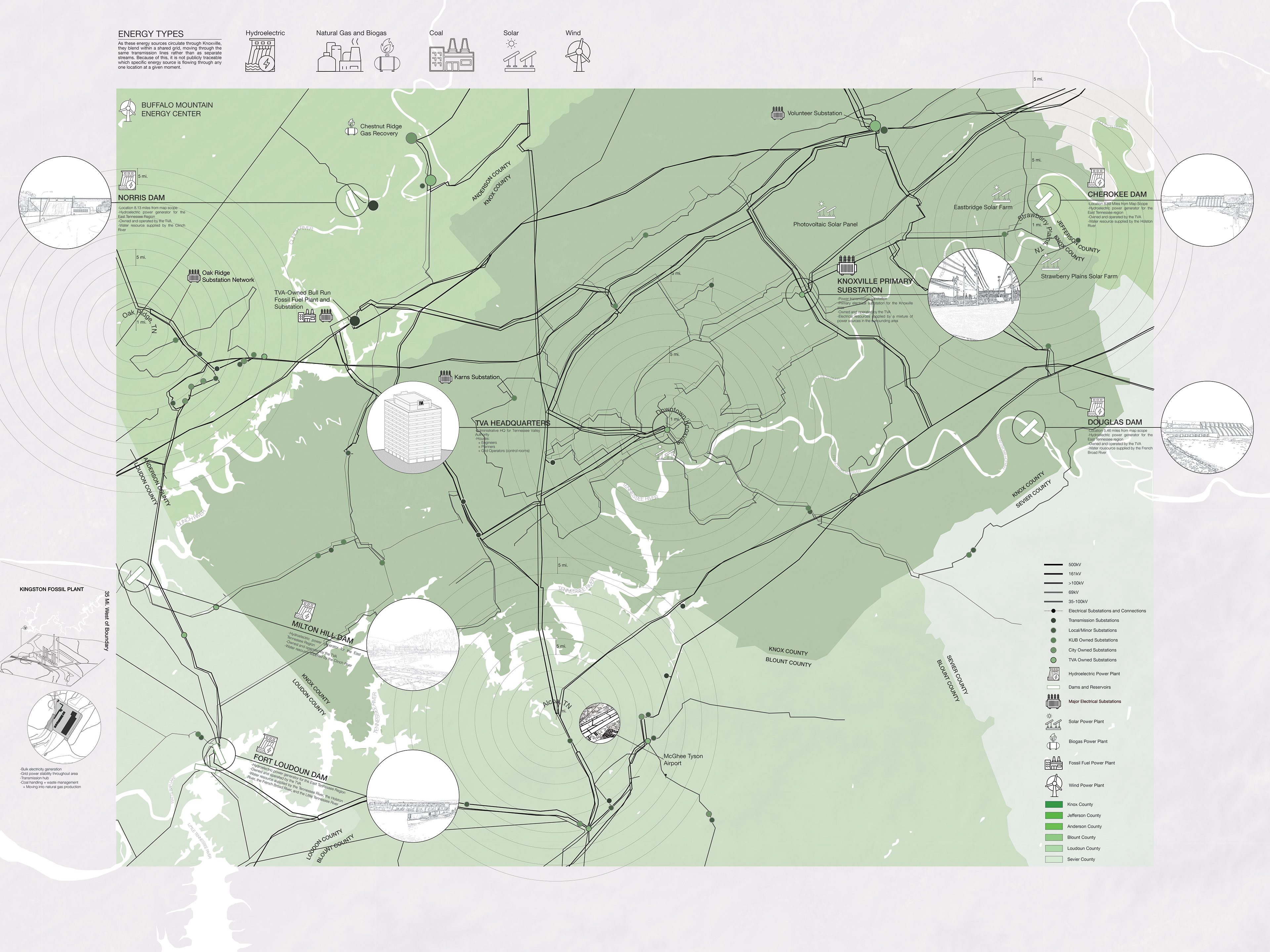

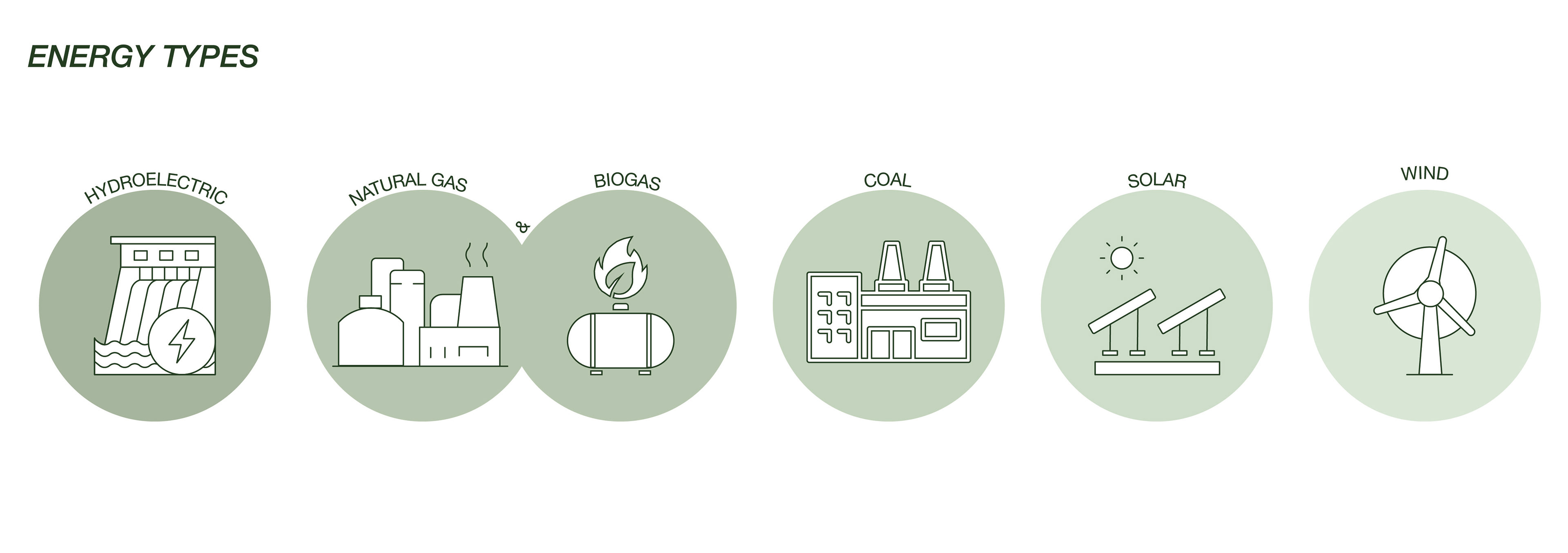
As these energy sources circulate through Knoxville, they blend within a shared grid, moving through the same transmission lines rather than as separate streams. Due to this, it is not publicly traceable which specific energy source is flowing through any location at a given moment.
A network of power lines with different voltages was traced throughout the Knoxville Free-Trade Zone region, specifically Knoxville, Alcoa, Oak Ridge, and Strawberry Plains. Electrical substations are dispersed along this network, distributing the incoming energy sources into the power lines. Locations of various energy power plant types are also indicated, with hydroelectric dams being the most prominent in the region due to the connection to the Tennessee River and its other branching rivers.
Phase 2 - Spatial Nodes
This phase further explores the spatial intersection of industrial, logistic, and energy systems in a confined node located at the border of Alcoa and Maryville, about 16 miles south of downtown Knoxville.
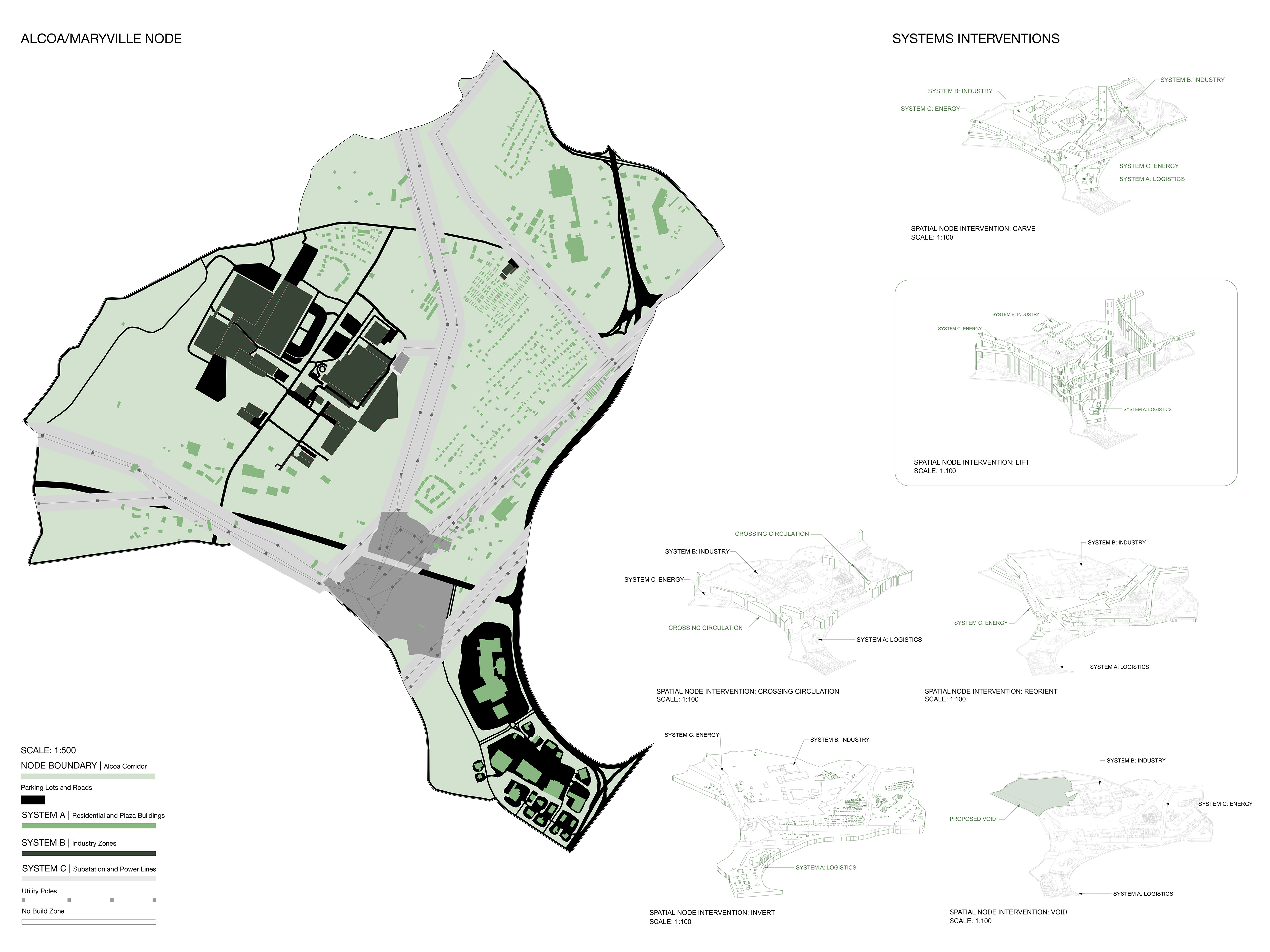
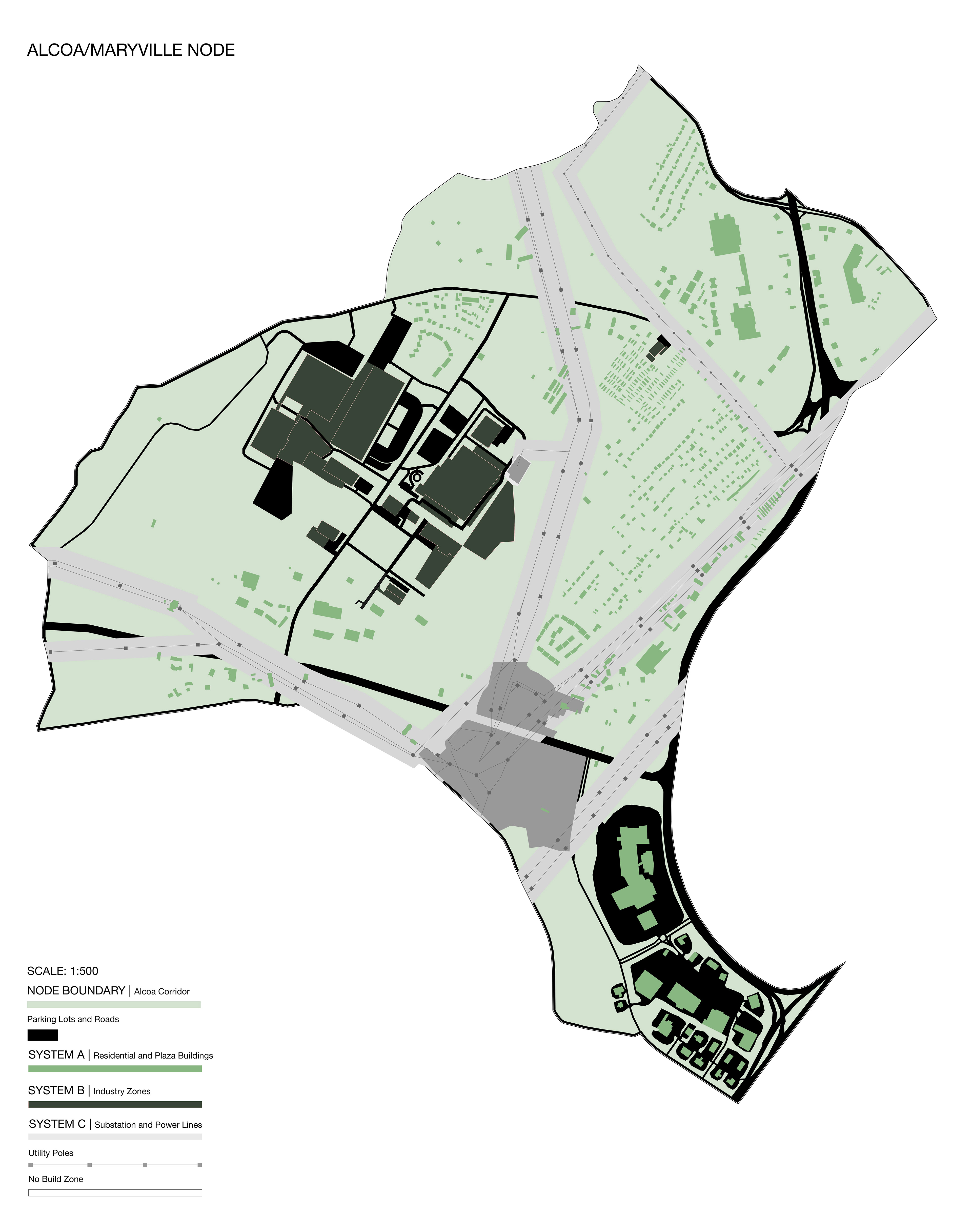
Of the three infrastructure systems observed, the energy network of power lines and a major substation is the primary system that orients the circulation of the two other adjacent systems. This energy corridor is a driving force for separating residential, manufacturing, and shopping centers, creating sense of disconnection in the city's design cause by these layers of infrastructure.
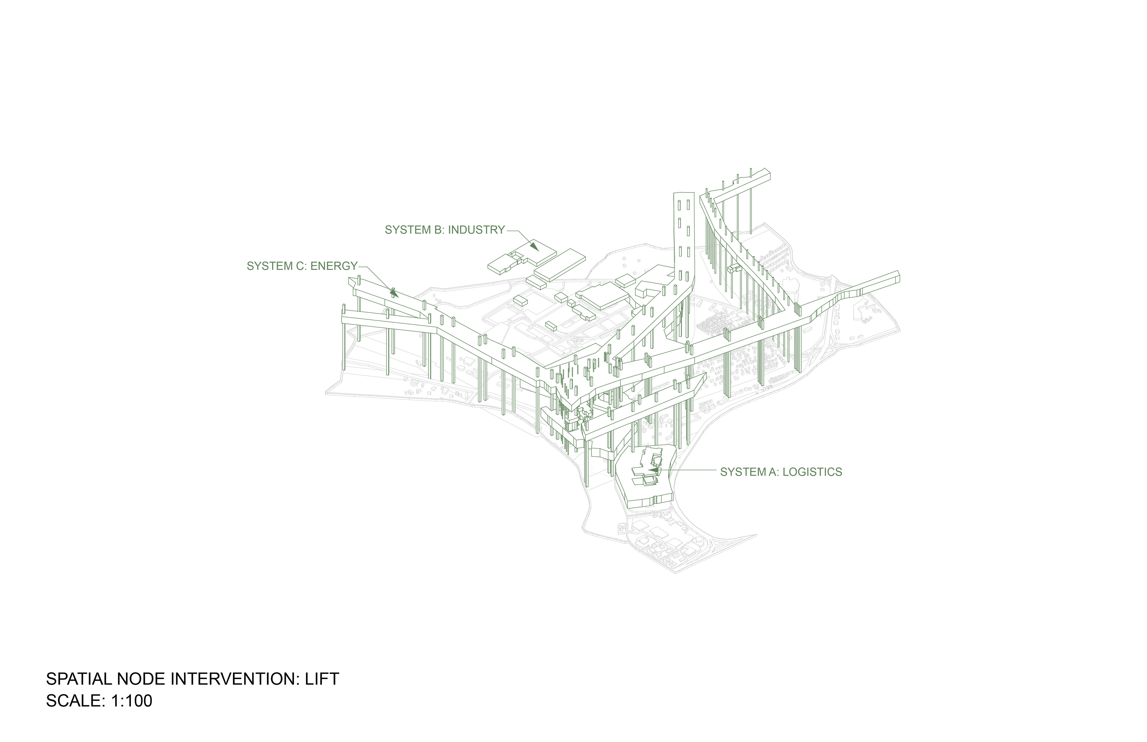
By studying the intersections of industrial, logistic, and energy systems along the border of Alcoa and Maryville, we identified opportunities for proposed infrastructural interventions at this site. After producing multiple iterations, the idea of lifting and elevating the boundary of the energy corridor to become infrastructure that connects the surrounding residential community to infrastructural resources influenced the final proposal.
Phase 2 - Spatial Nodes - Site Visit
A site visit to the Alcoa-Maryville border was executed to see the urban landscape and better understand the layers of infrastructure occurring on site.
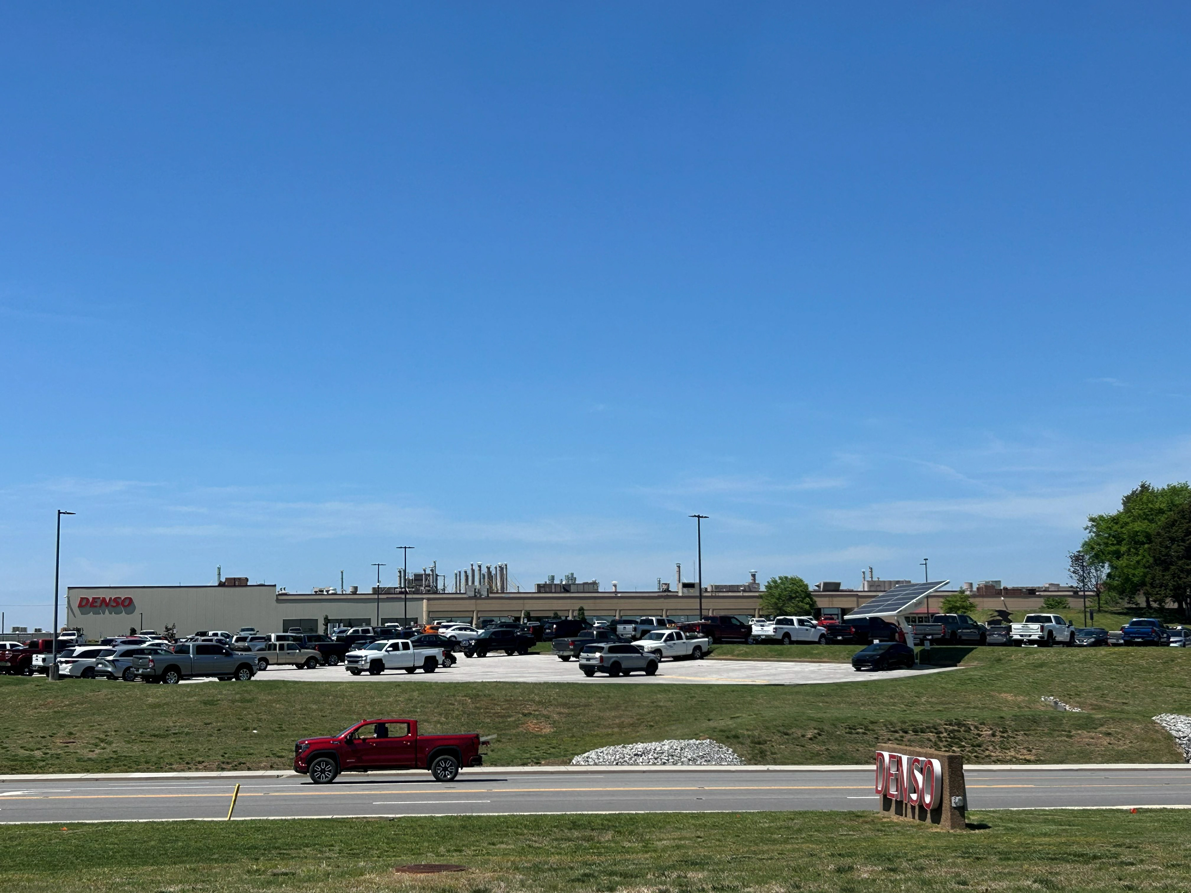
Site Image 1 - DESCO Manufacturing Campus
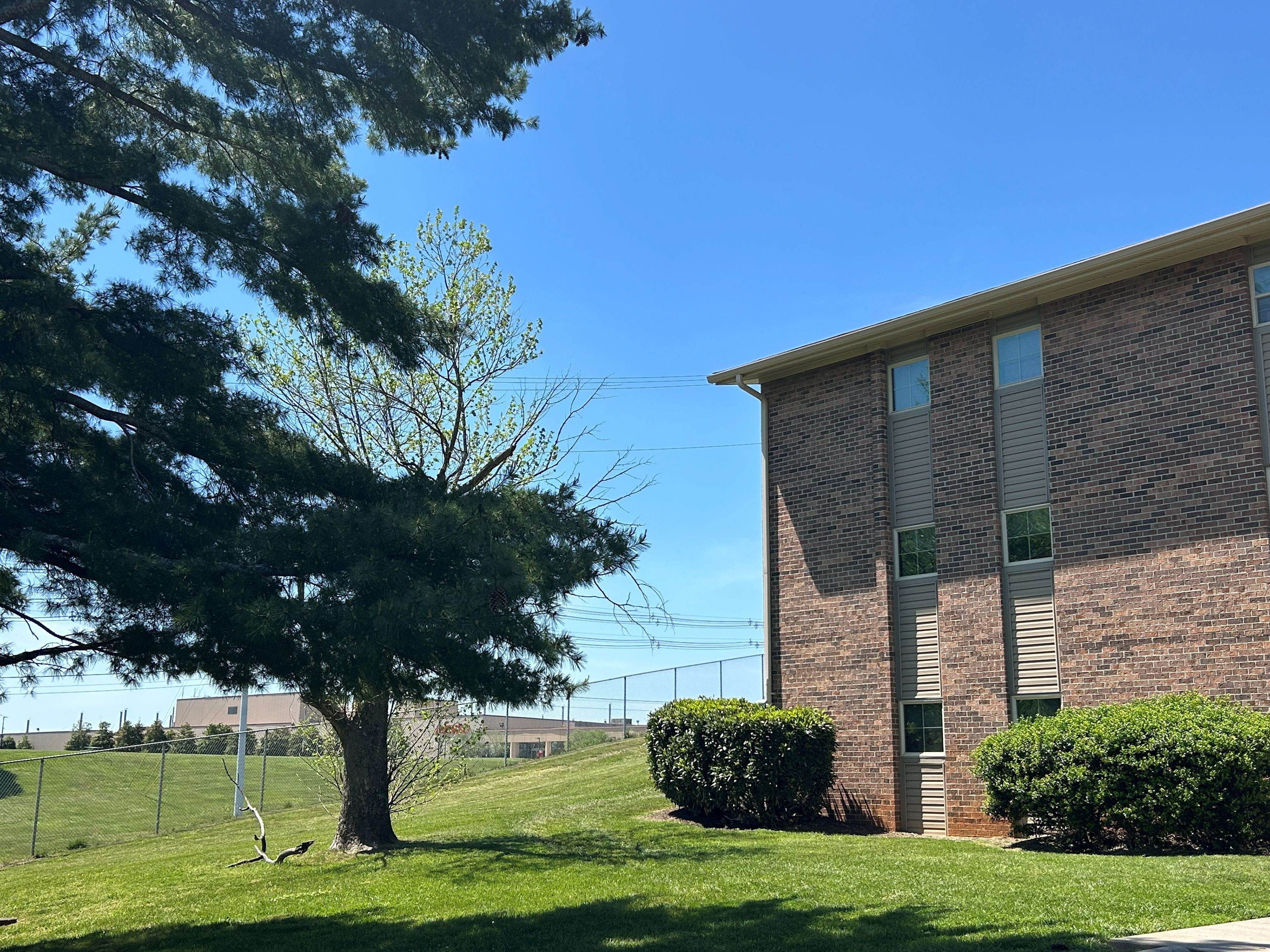
Site Image 2 - Apartment Complex Next to DESCO Manufacturing Campus
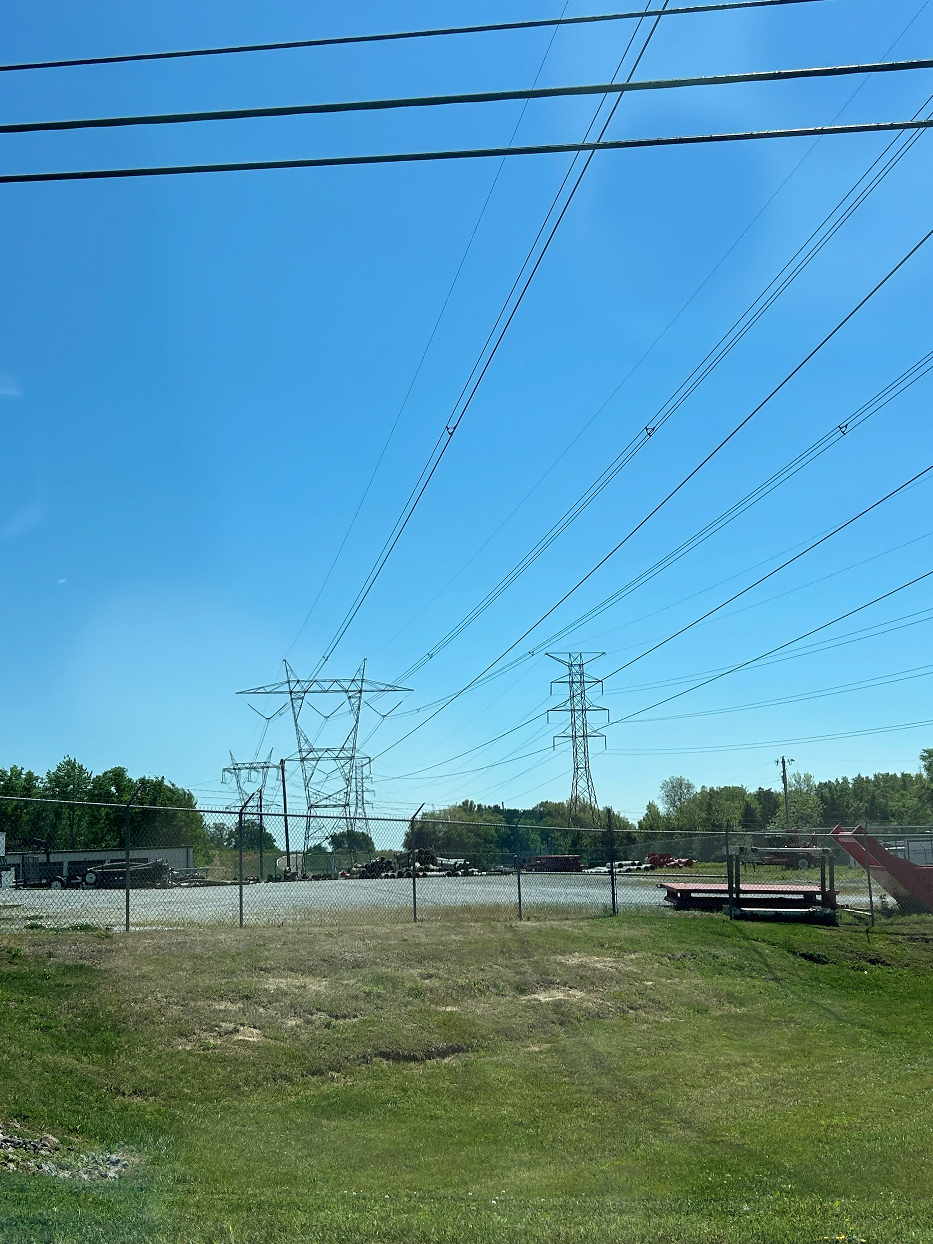
Site Image 3 - Power Lines and Power Towers
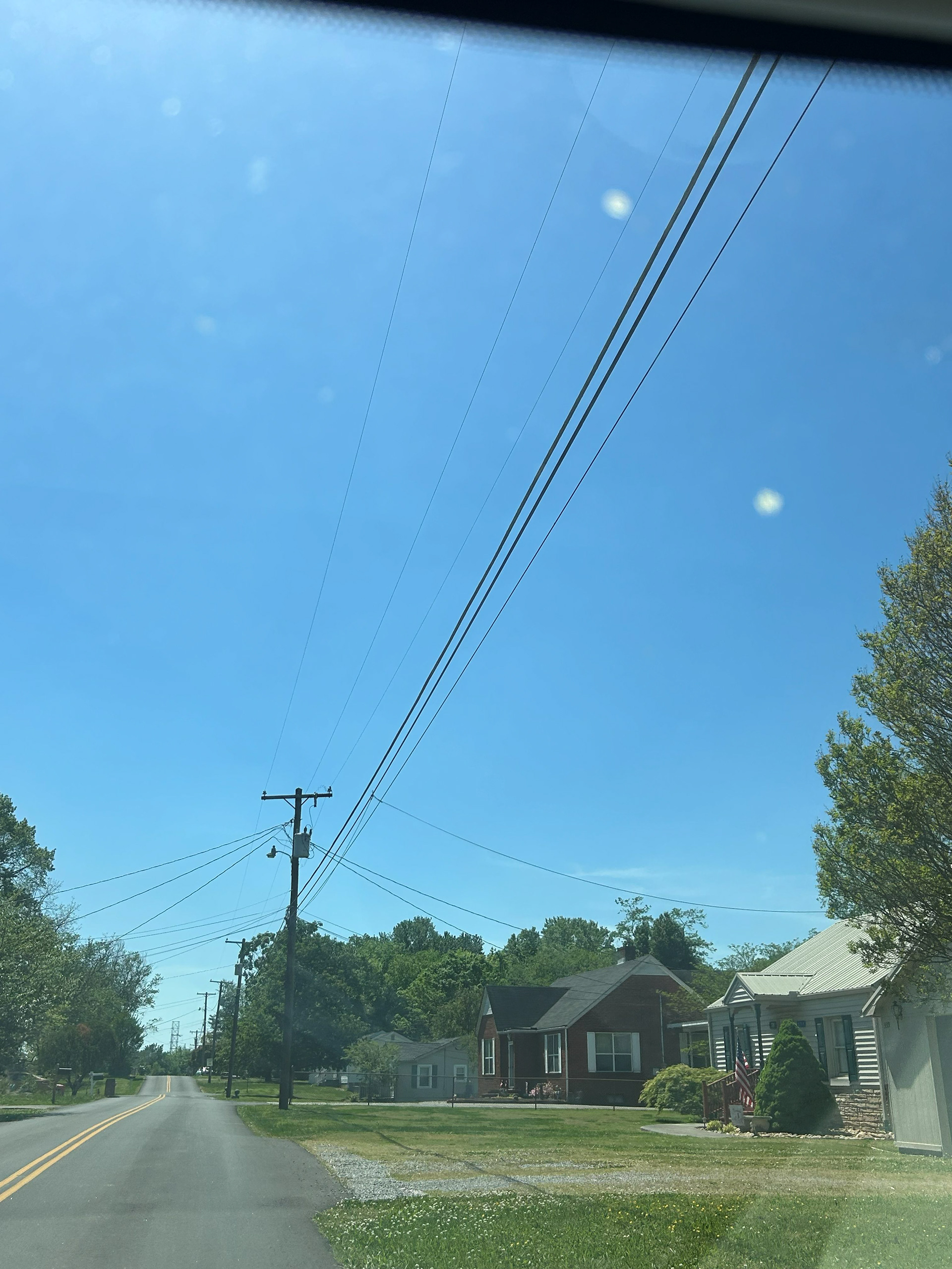
Site Image 4 - Neighborhood Streets
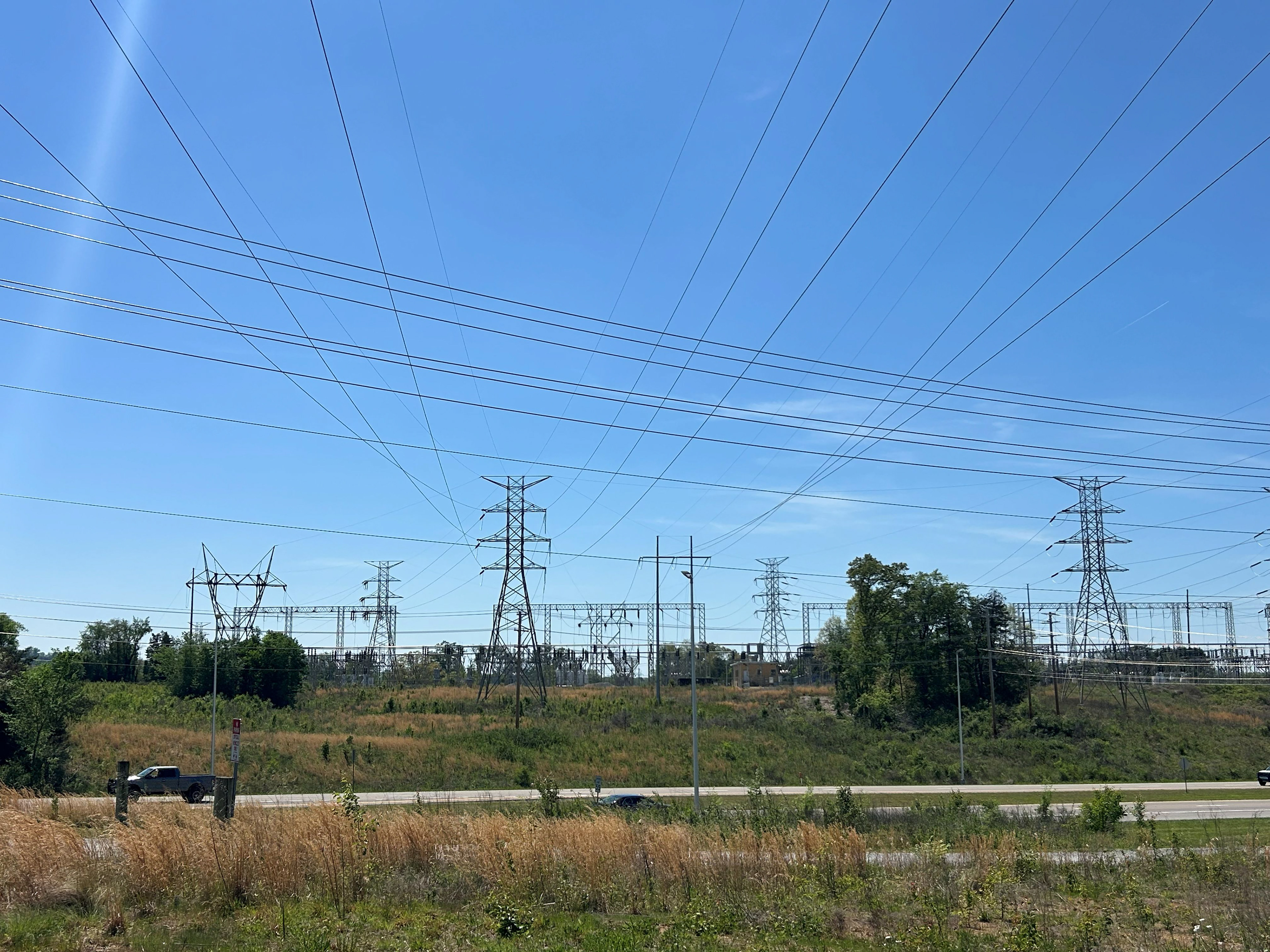
Site Image 5 - Collection of Power Lines and Power Towers Near Alcoa Switching Substation
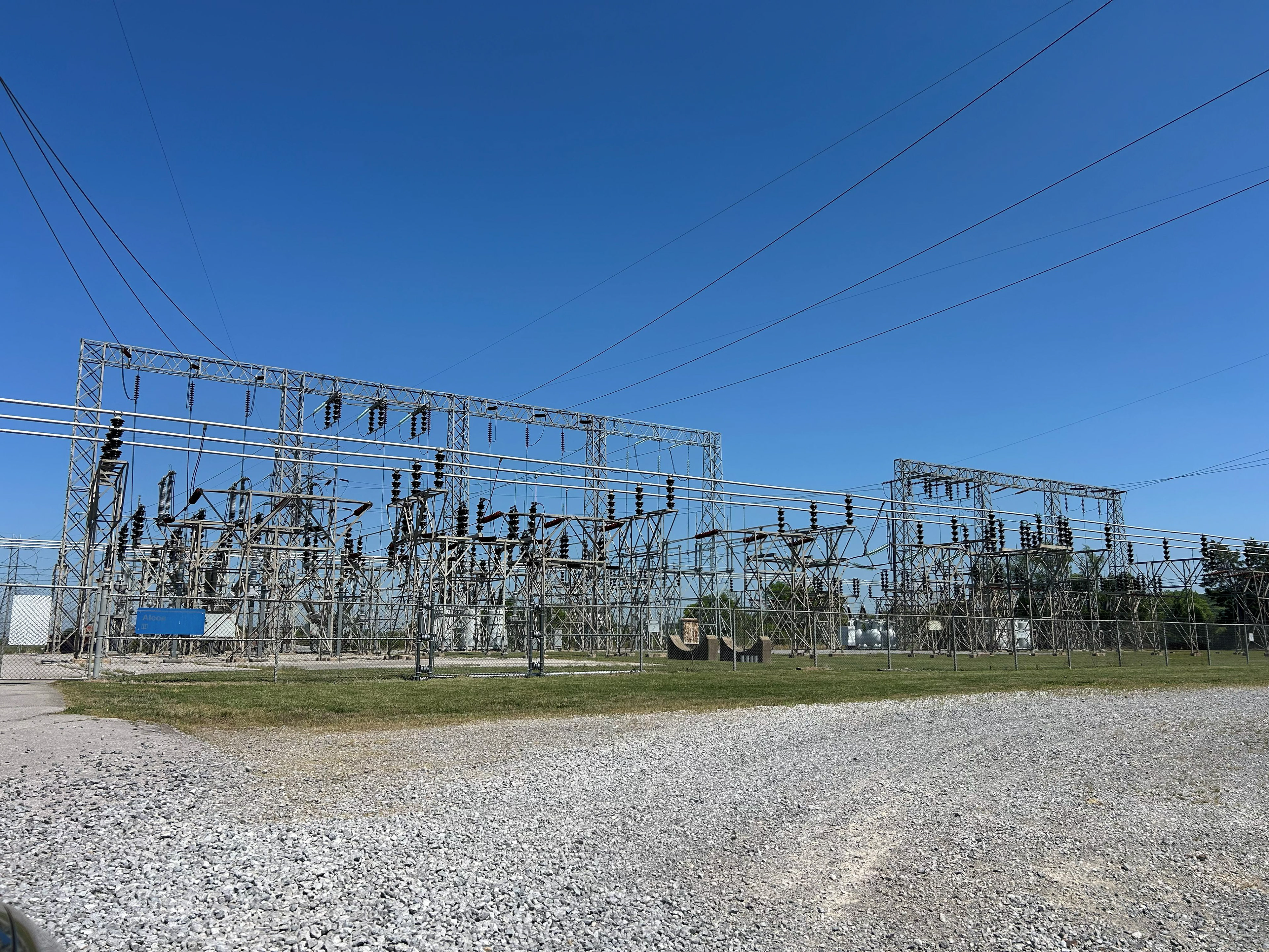
Site Image 6 - Alcoa Switching Substation
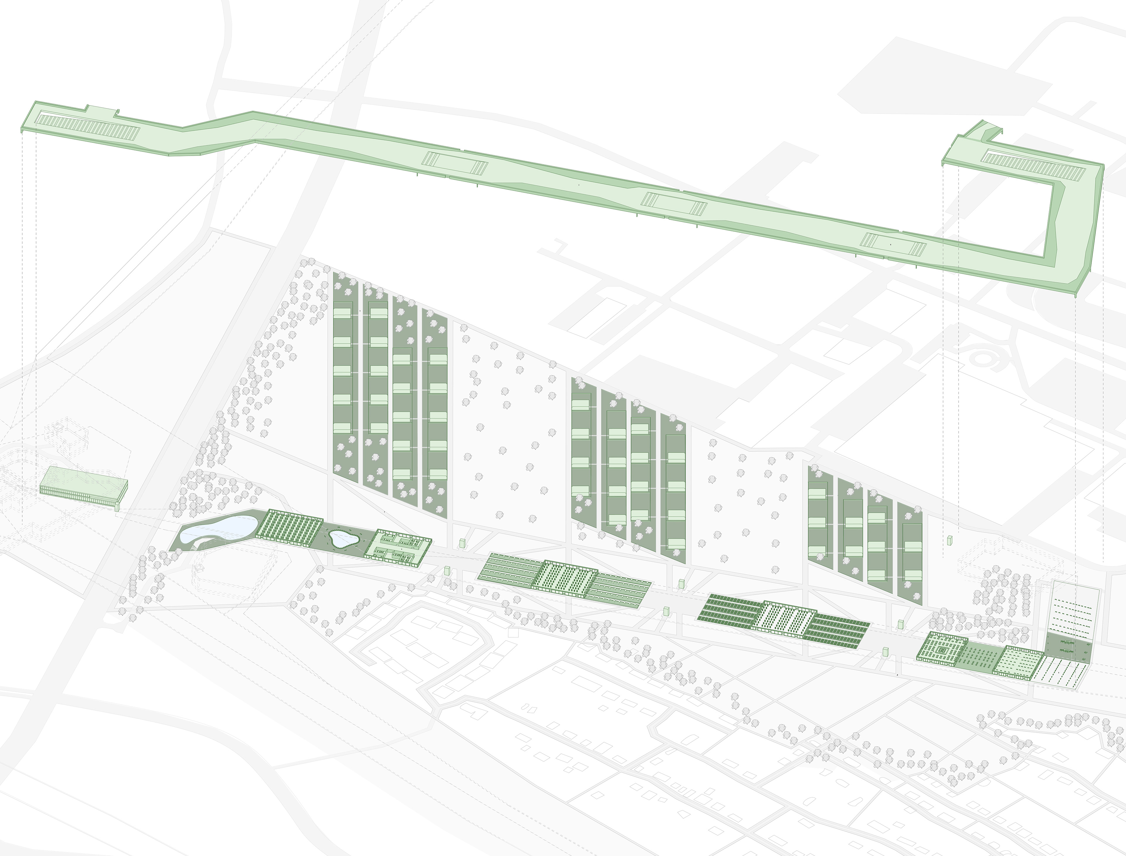
Phase 3 - Cultivated Infrastructure Proposal
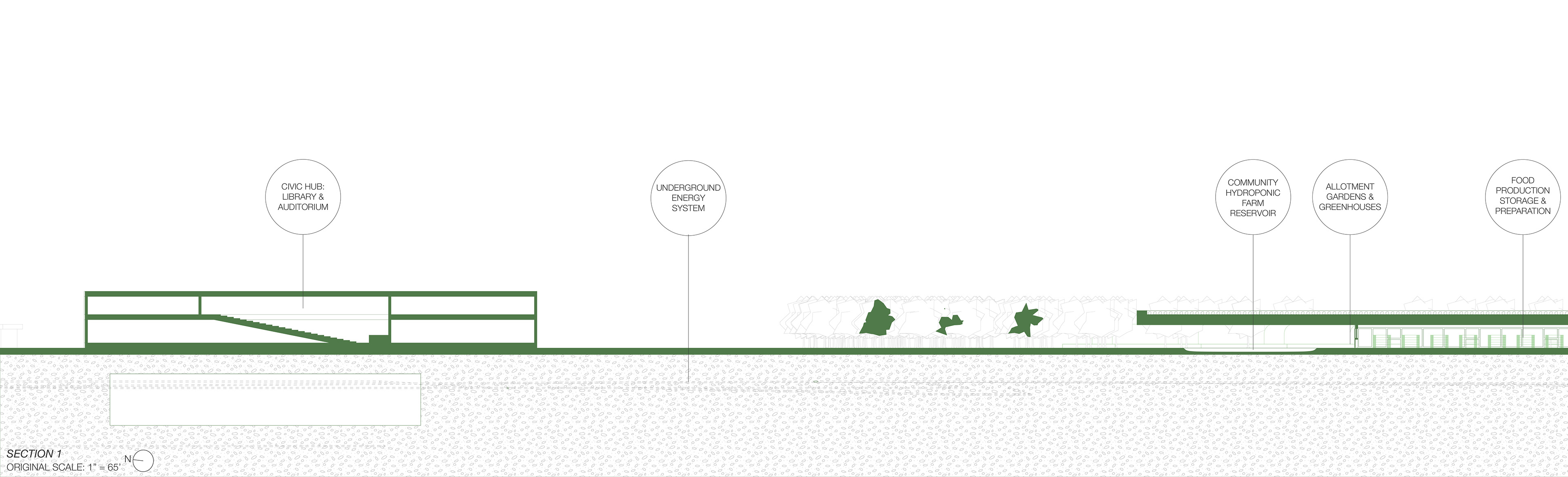
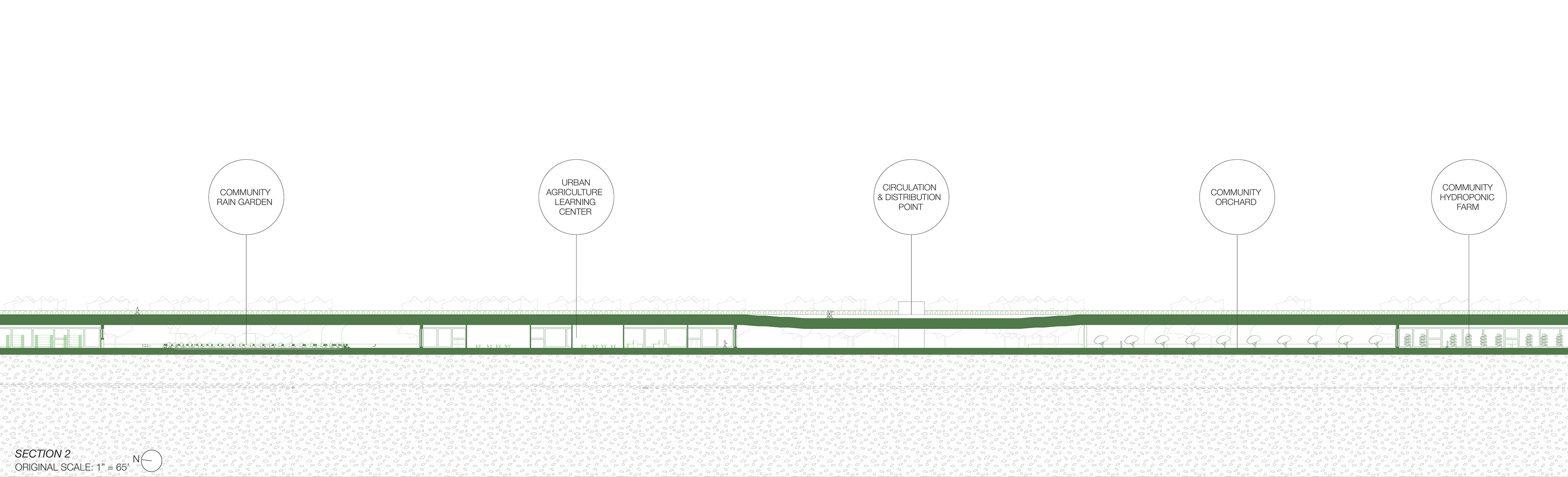
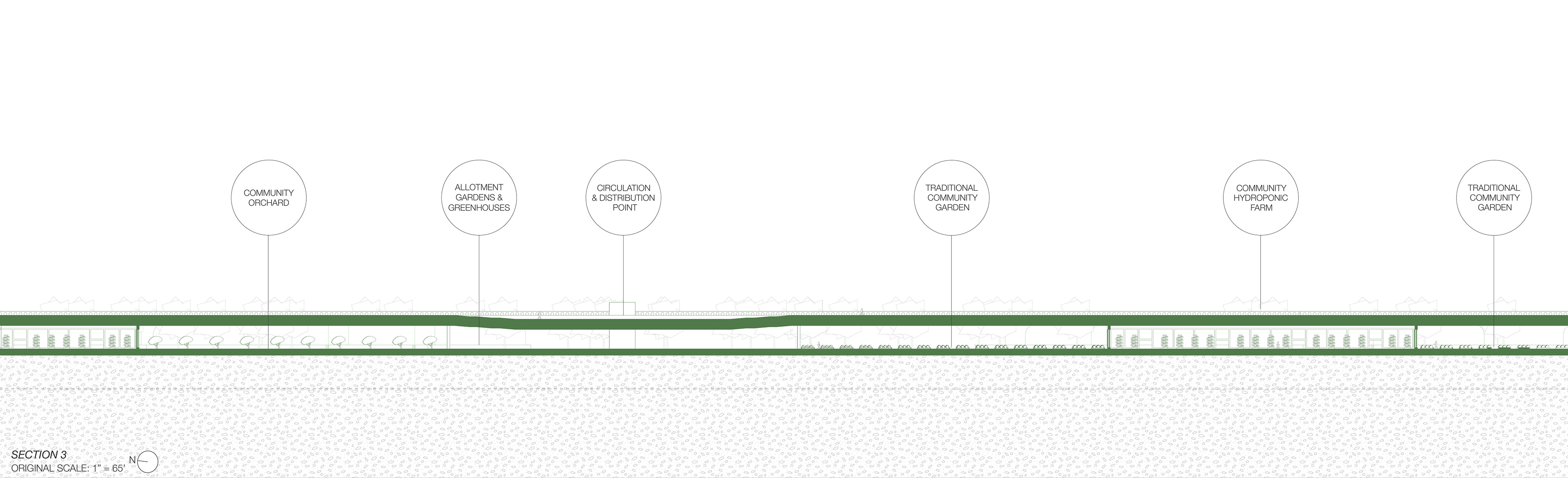
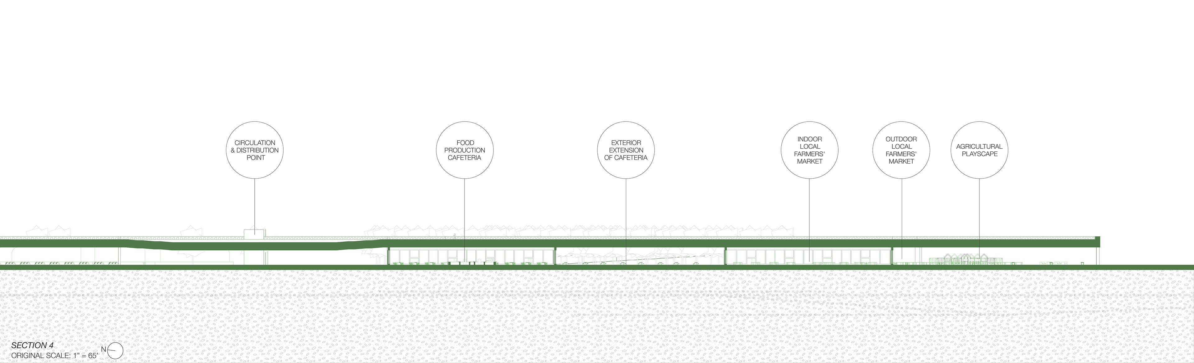
This proposal, Cultivated Infrastructure, explores how industrial and energy systems can be reimagined as active civic landscapes that support accessible circulation, public occupation, and localized food production. Situated between an adjacent residential neighborhood and a redeveloped manufacturing campus, the project transforms an existing energy corridor into a multifunctional infrastructural hub reconnecting fragmented urban conditions while establishing new relationships between energy, urban agriculture, and community engagement.
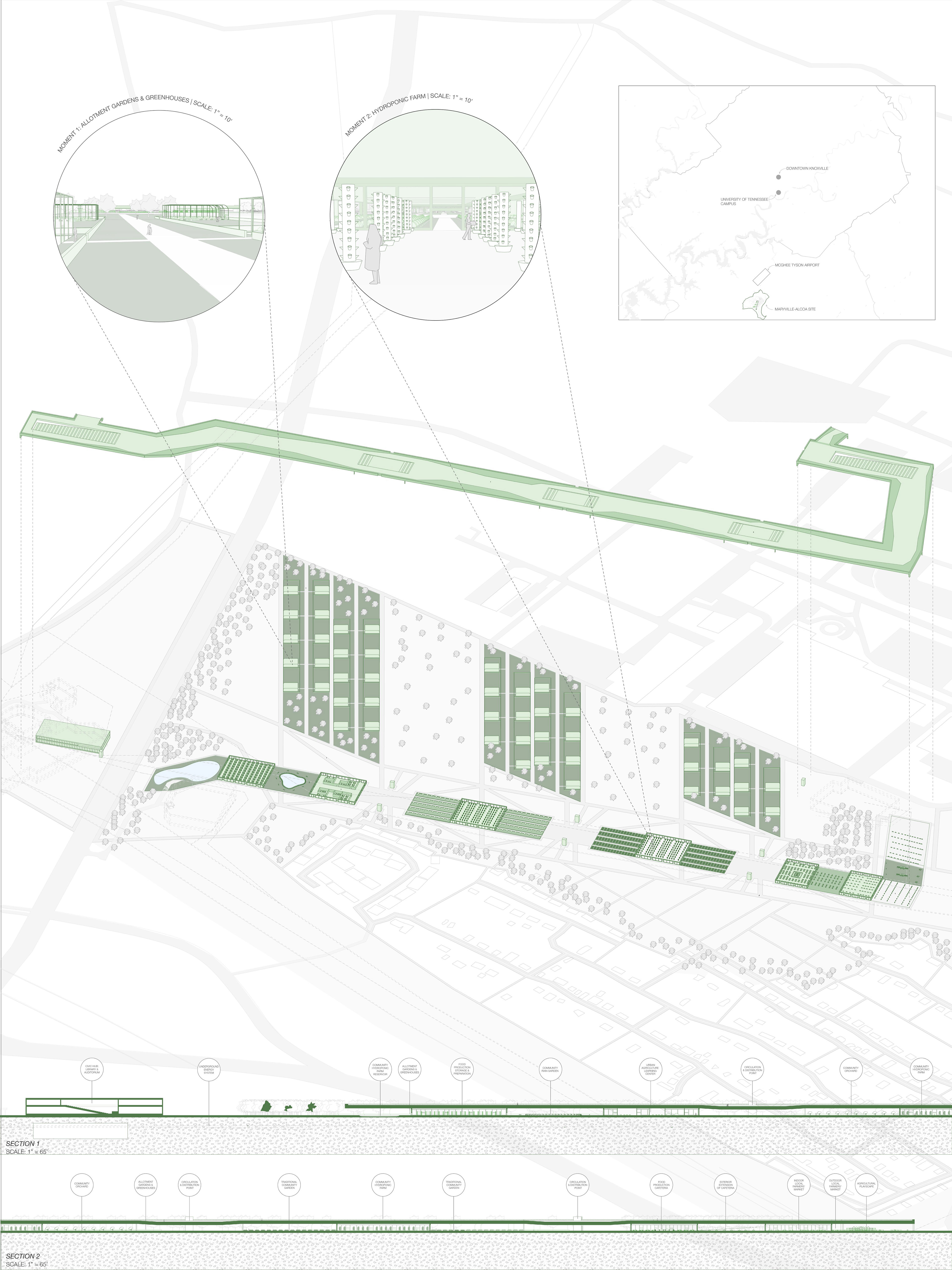
By relocating the energy system underground to improve efficiency and public safety, Cultivated Infrastructure frees the corridor for public use by providing green spaces accessible to nearby neighborhoods. In its place, an elevated pathway extends across the site as both a circulation network and a framework for occupation, as it organizes circulation while creating spaces for gathering, learning, and cultivation. This linear system operates as a vessel for agricultural programs, including hydroponic gardens, orchards, allotment greenhouses, and markets that encourage collective stewardship and local food production.
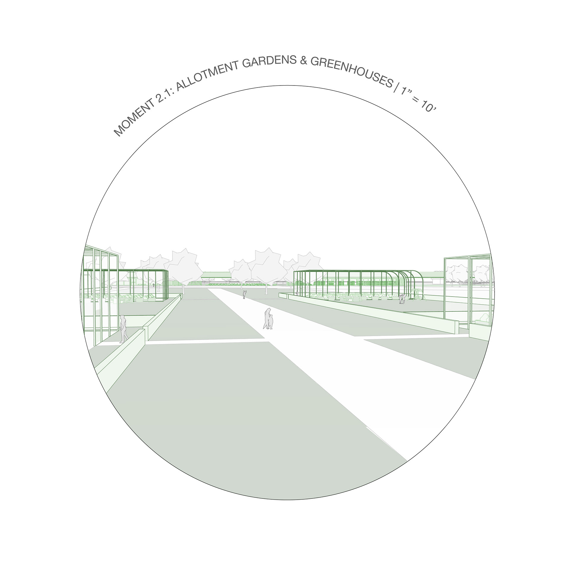
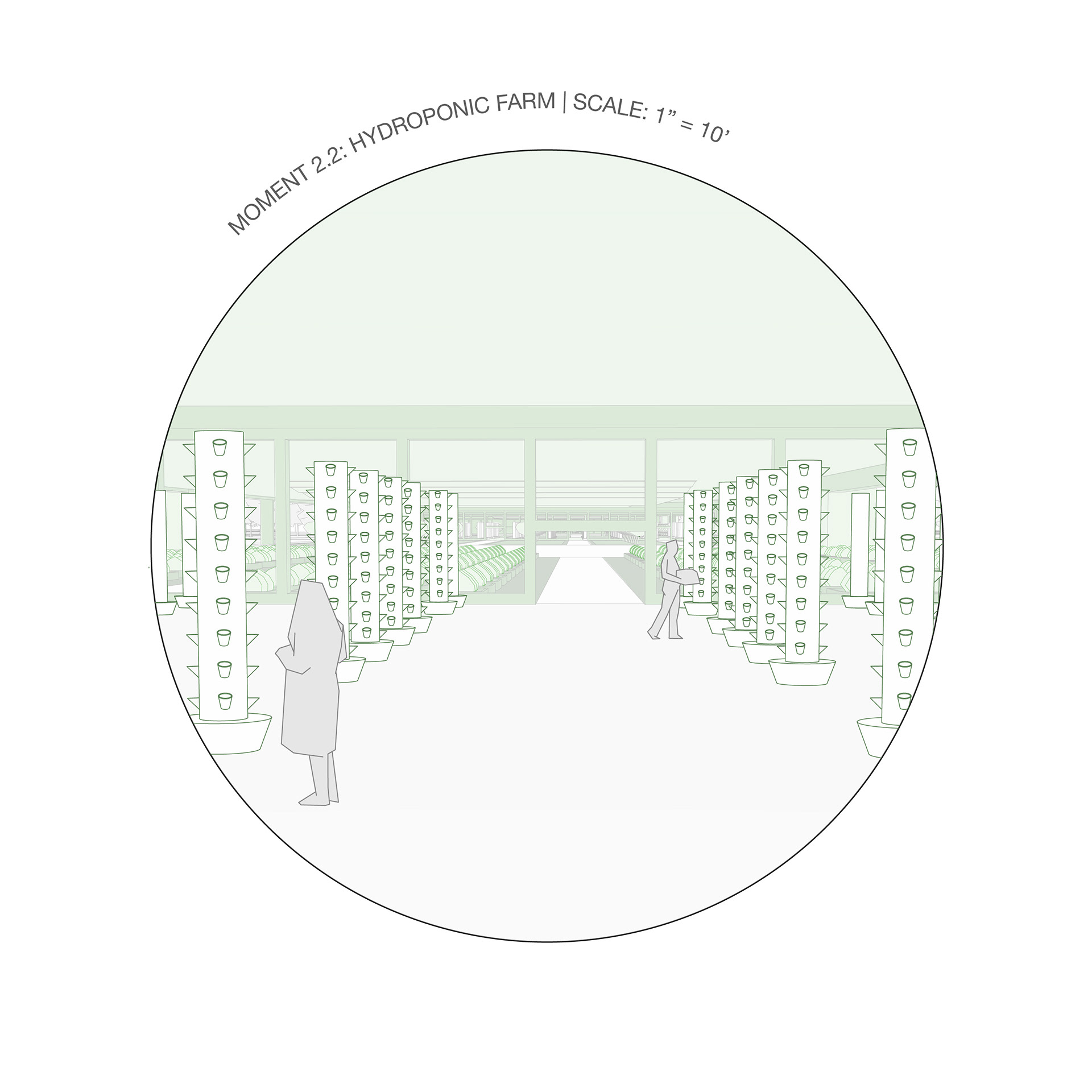
Water collection and environmental systems further reinforce the productive landscape, integrating irrigation reservoirs and rain gardens into the architectural and infrastructural framework. Rather than separating agriculture utility systems from public life, these processes become visible and engaging, embedding energy, water, and food production within the urban experience. The pathway is elevated above these urban agricultural spaces at a human scale to avoid imposing infrastructure that would further disconnect the surrounding communities.